Cemeteries
We have compiled a searchable list of Crawford County cemeteries for those interested in history and genealogy studies.
Crawford County Cemeteries
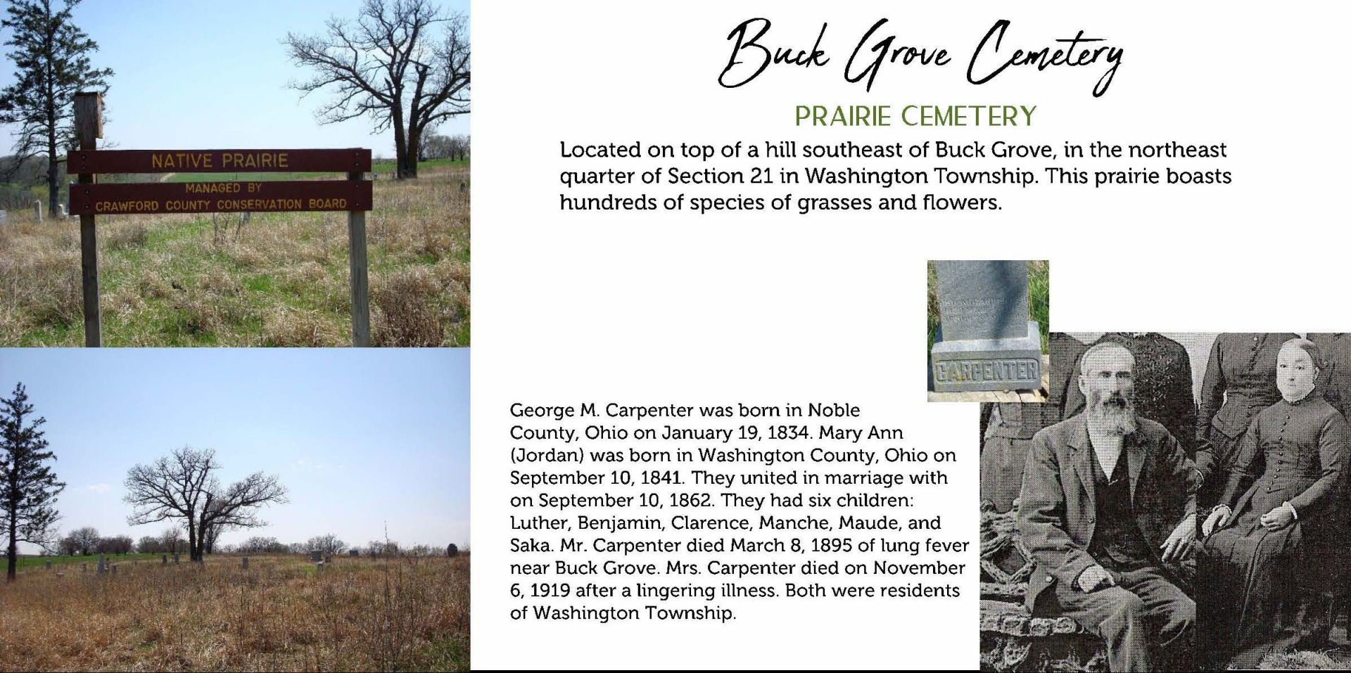
Buck Grove Cemetery
Latitude: 41.906 · Longitude: -95.384 · Google MapsWashington Township · Section 21, Township 82, Range 39 · Township Officials
Butler Cemetery (aka Arion Cemetery)
Latitude: 41.9363 · Longitude: -95.4627 · Google MapsUnion Township · Section 02, Township 82, Range 40 · Township Officials
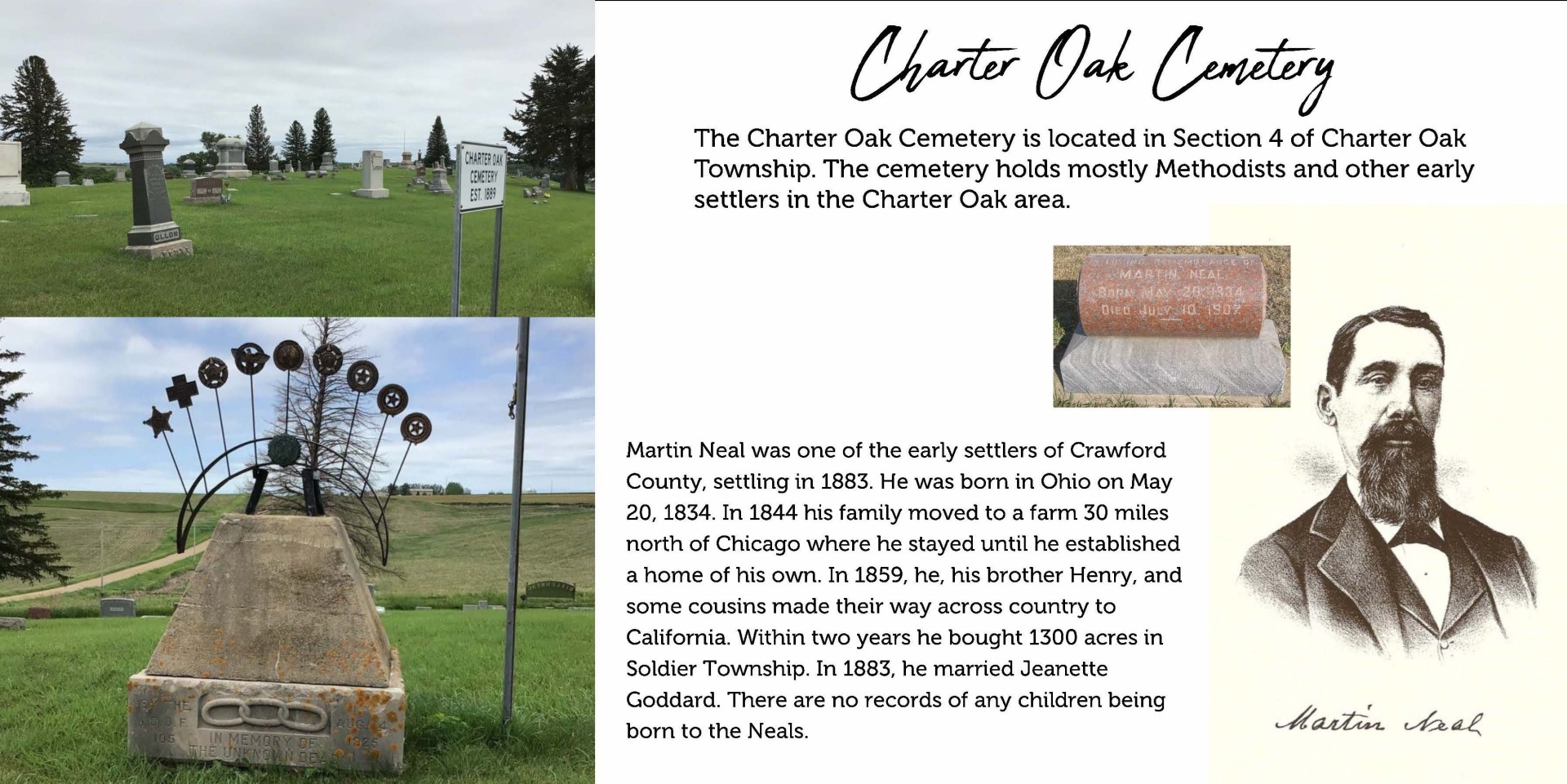
Charter Oak Cemetery
Latitude: 42.0815 · Longitude: -95.5932 · Google MapsCharter Oak Township · Section 14, Township 84, Range 41 · Township Officials
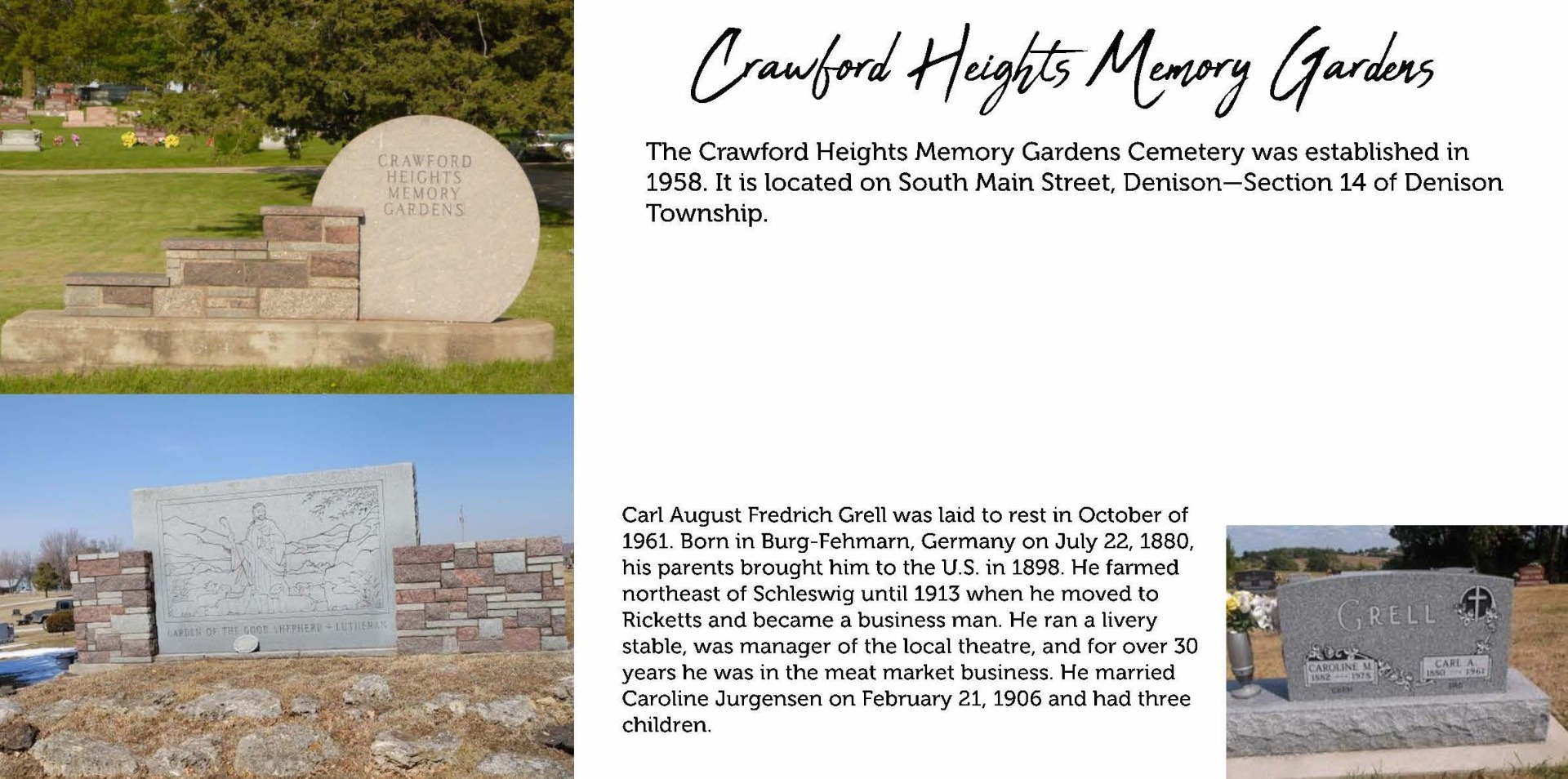
Crawford Heights Memory Gardens
Latitude: 41.9999 · Longitude: -95.3483 · Google MapsDenison Township · Section 14, Township 83, Range 39 · Township Officials
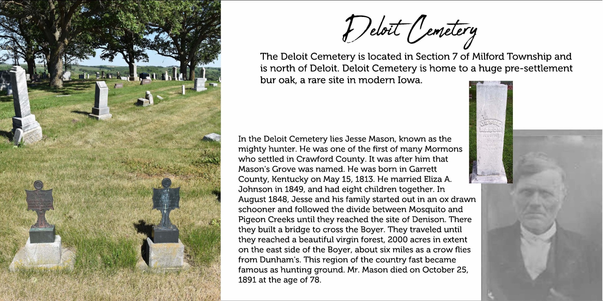
Deloit Cemetery
Latitude: 42.1080 · Longitude: -95.3137 · Google MapsMilford Township · Section 07, Township 84, Range 38 · Township Officials
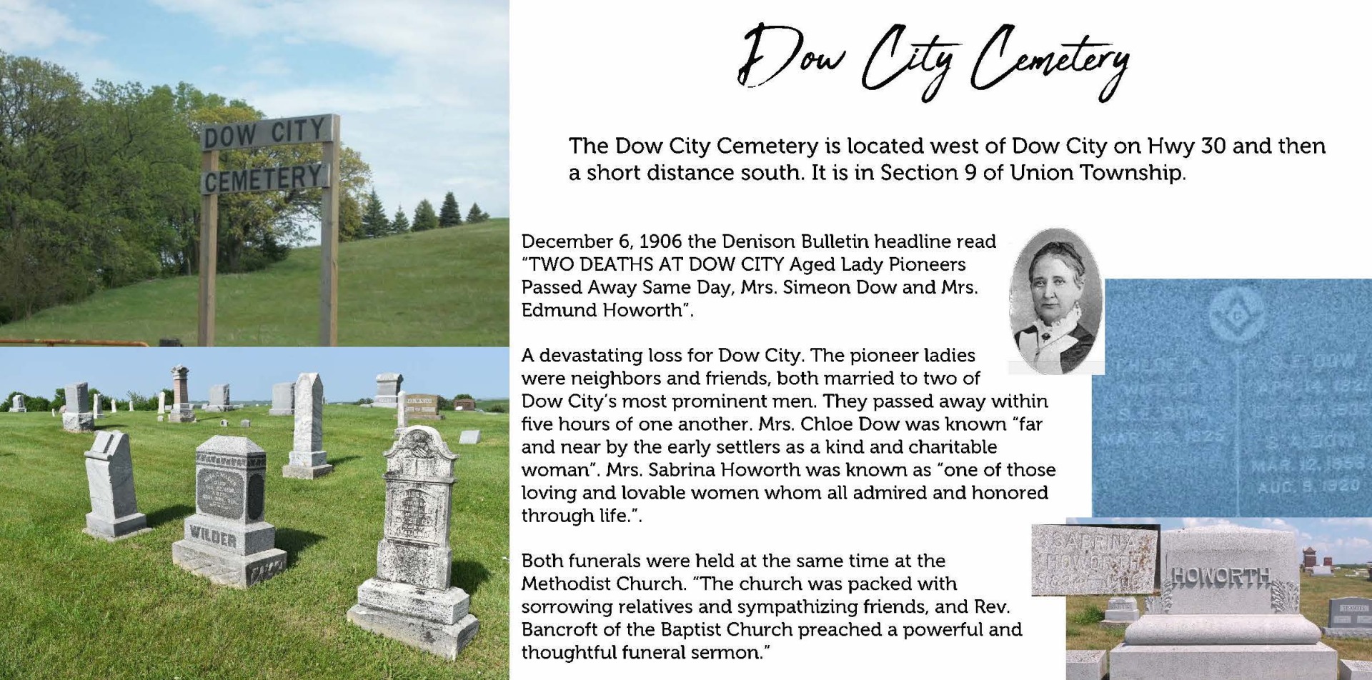
Dow City Cemetery
Latitude: 41.9220 · Longitude: -95.5130 · Google MapsUnion Township · Section 09, Township 82, Range 40 · Township Officials
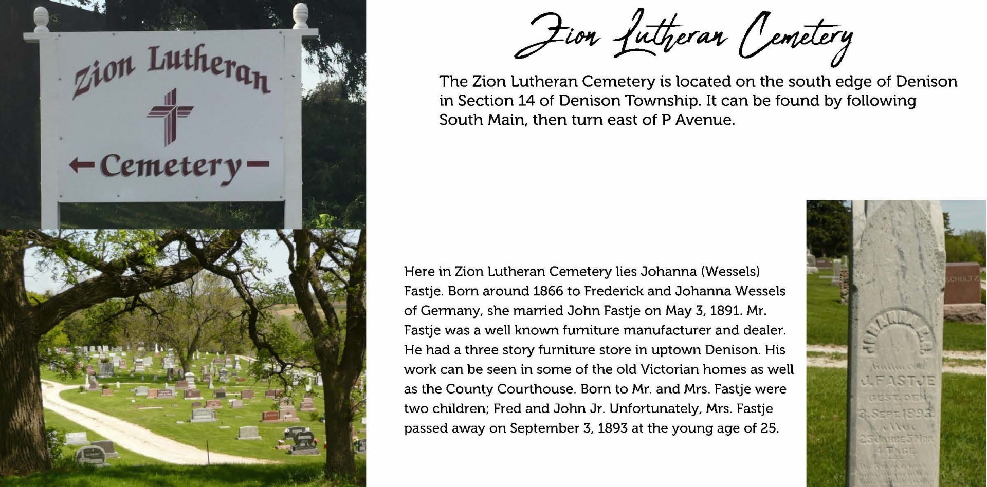
German Evangelical Lutheran Zion's Cemetery
Latitude: 41.9950 · Longitude: -95.3454 · Google MapsDenison Township · Section 14, Township 83, Range 39 · Township Officials
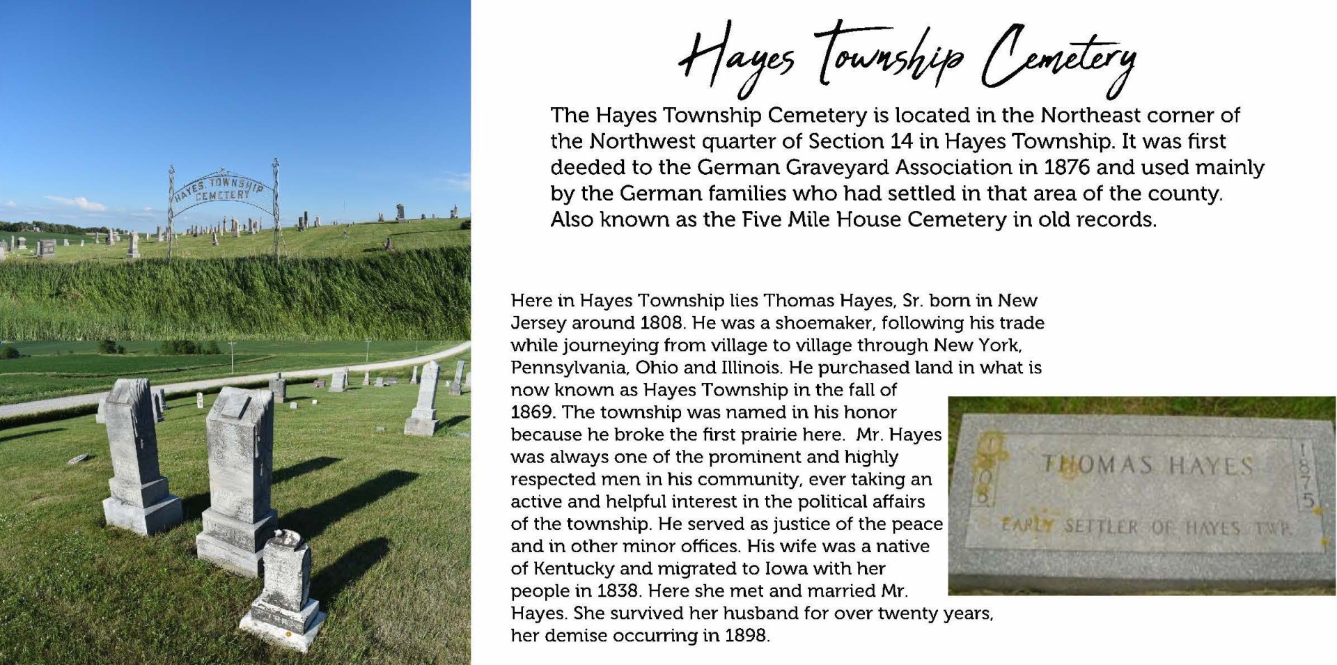
Hayes Township Cemetery (aka German Graveyard Association)
Latitude: 42.0087 · Longitude: -95.1226 · Google MapsHayes Township · Section 14, Township 83, Range 37 · Township Officials
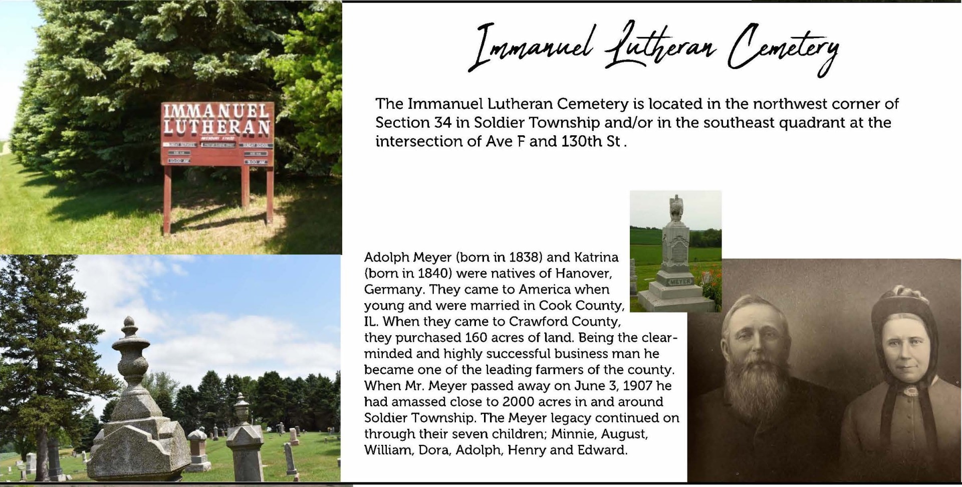
Immanuel Lutheran Cemetery (aka Trustees German Lutheran Church Society)
Latitude: 42.1384 · Longitude: -95.6133 · Google MapsSoldier Township · Section 34, Township 85, Range 41 · Township Officials
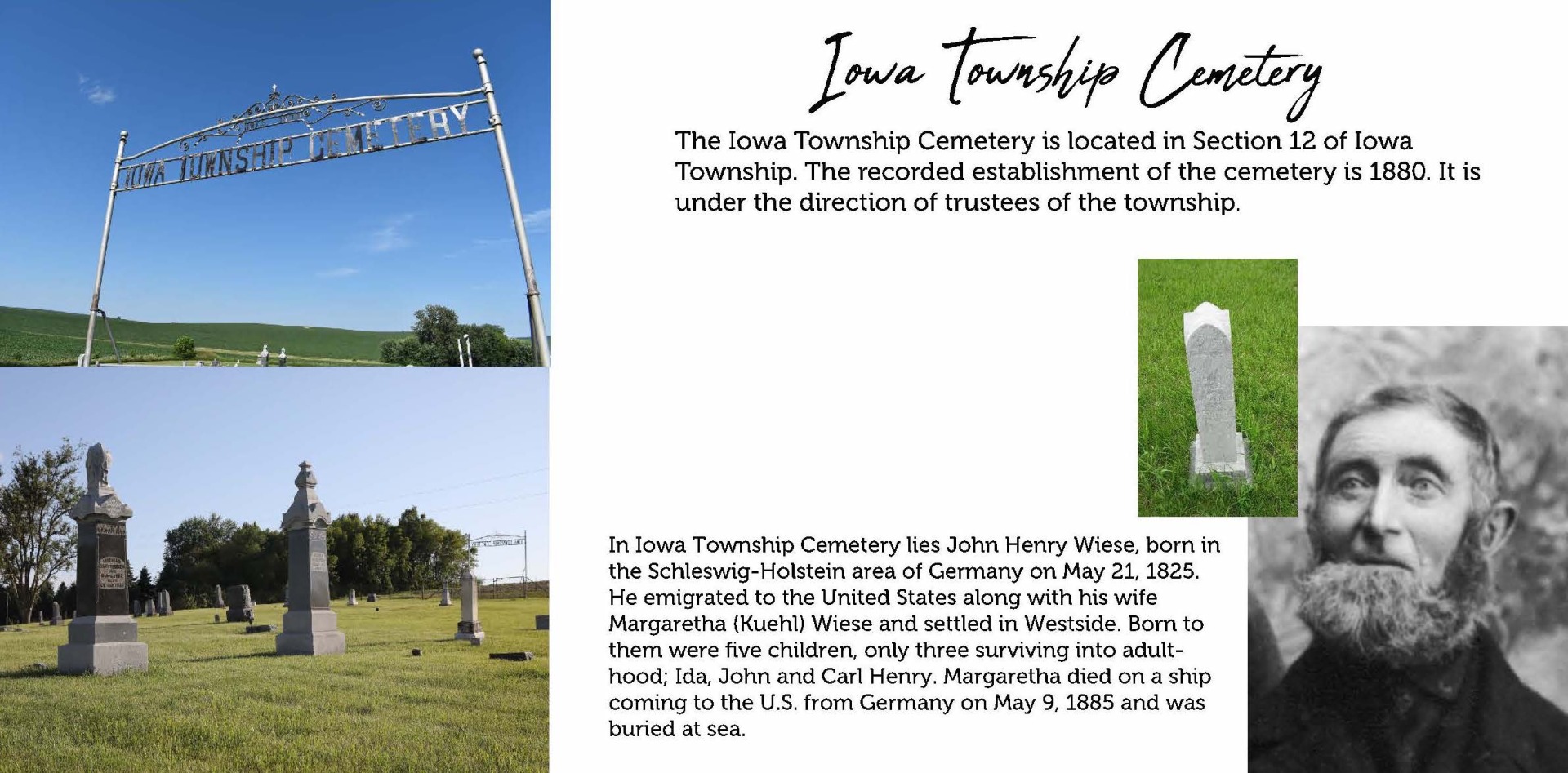
Iowa Township Cemetery
Latitude: 41.9218 · Longitude: -95.1121 · Google MapsIowa Township · Section 12, Township 82, Range 37 · Township Officials
King Cemetery
Latitude: 42.1011 · Longitude: -95.2321 · Google MapsMilford Township · Section 11, Township , Range · Township Officials

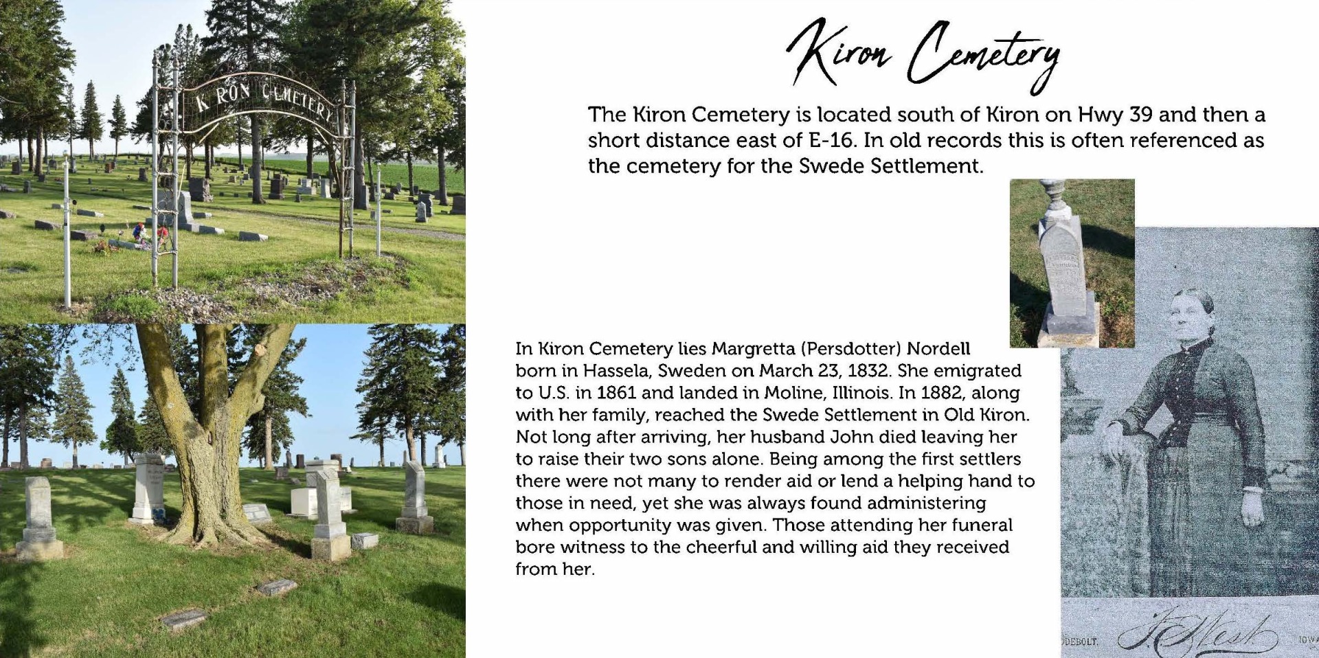
Kiron Cemetery
Latitude: 42.1822 · Longitude: -95.3135 · Google MapsStockholm Township · Section 18, Township 85, Range 38 · Township Officials
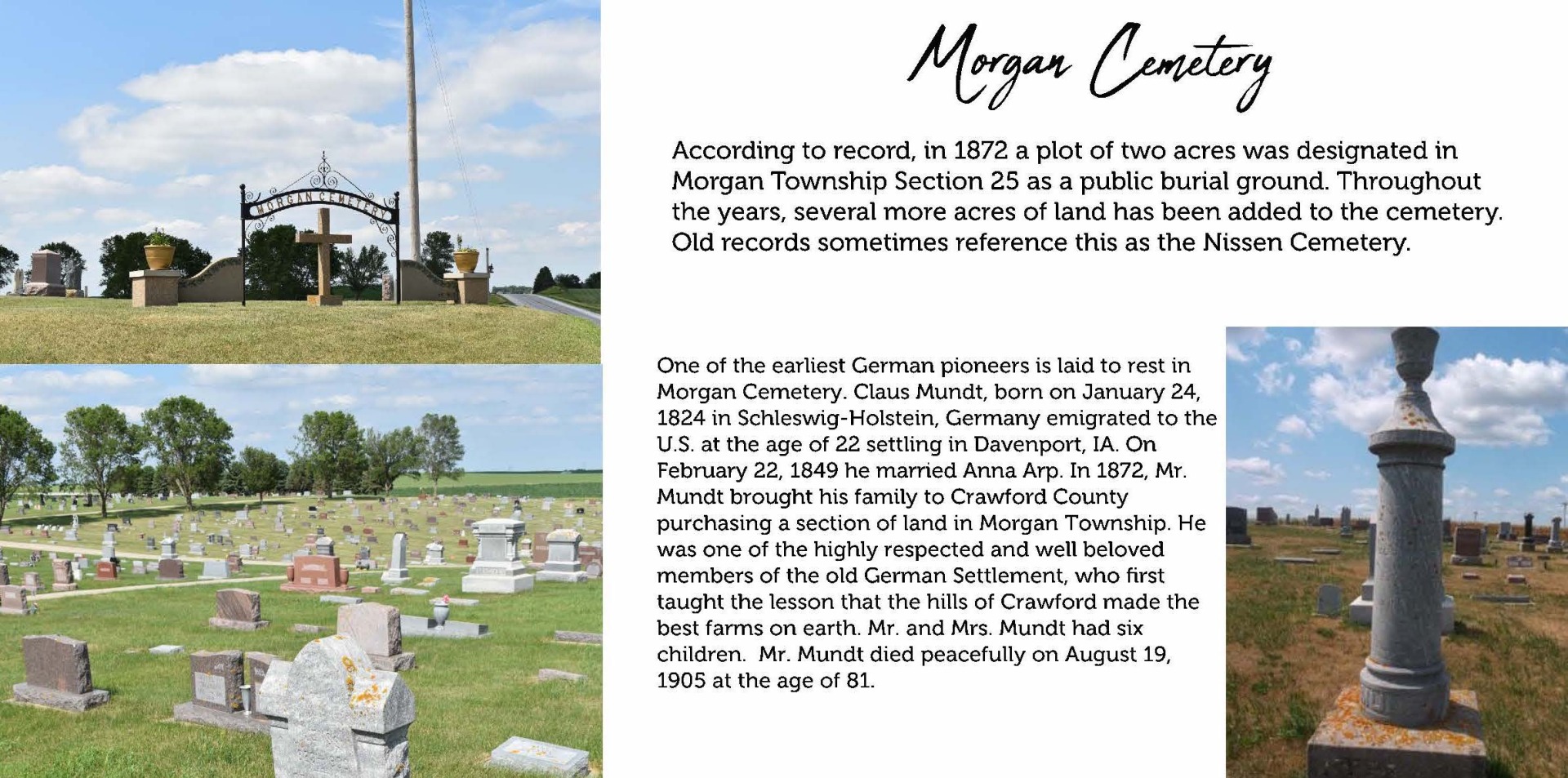
Morgan Township Cemetery
US-59, Schleswig, IA 51461Latitude: 42.1398 · Longitude: -95.4403 · Google Maps
Morgan Township · Section 25, Township 85, Range 40 · Township Officials
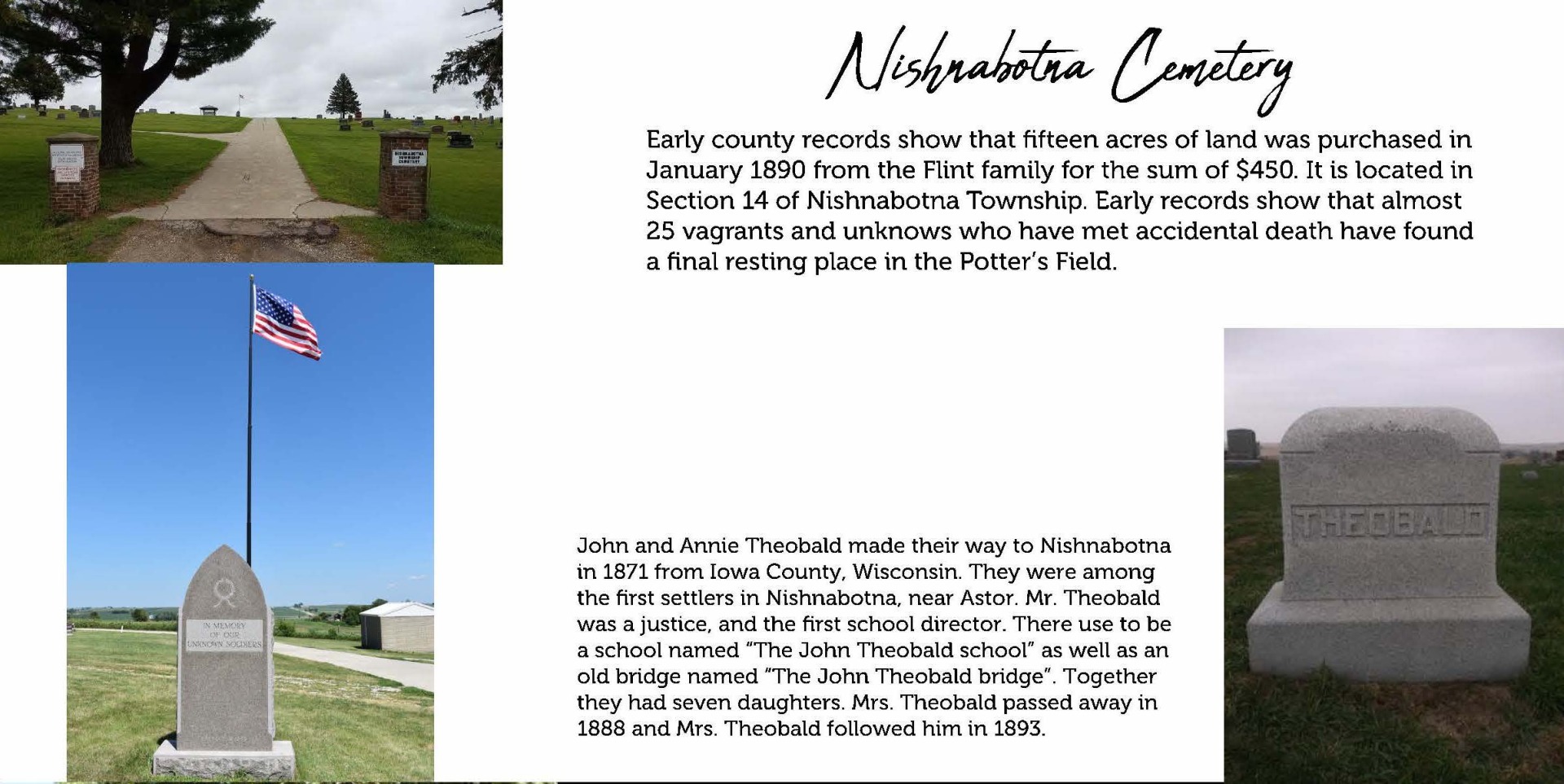
Nishnabotna Township Cemetery
Latitude: 41.9087 · Longitude: -95.2471 · Google MapsNishnabotna Township · Section 14, Township 82, Range 38 · Township Officials
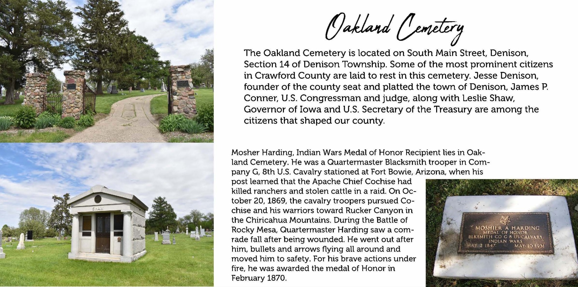
Oakland Cemetery
Latitude: 41.9979 · Longitude: -95.3474 · Google MapsDenison Township · Section 14, Township 83, Range 39 · Township Officials
Old Catholic Cemetery
East Boyer Township · Section 18, Township , Range · Township Officials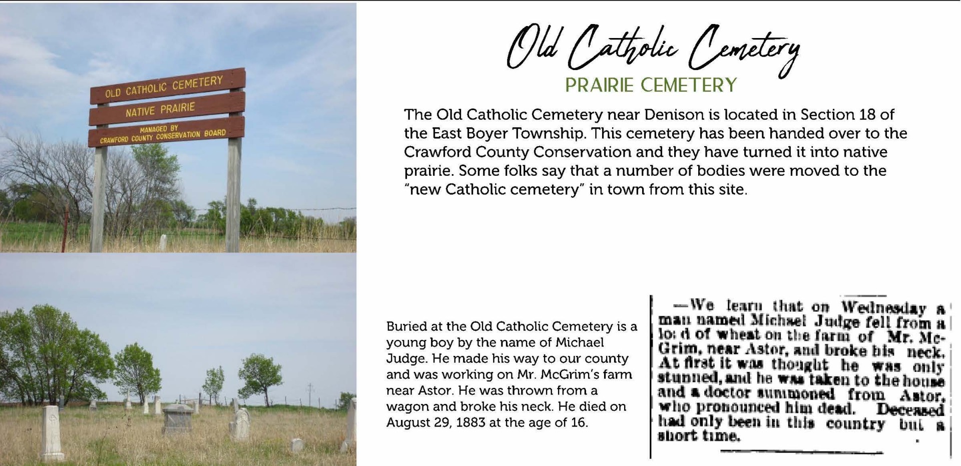
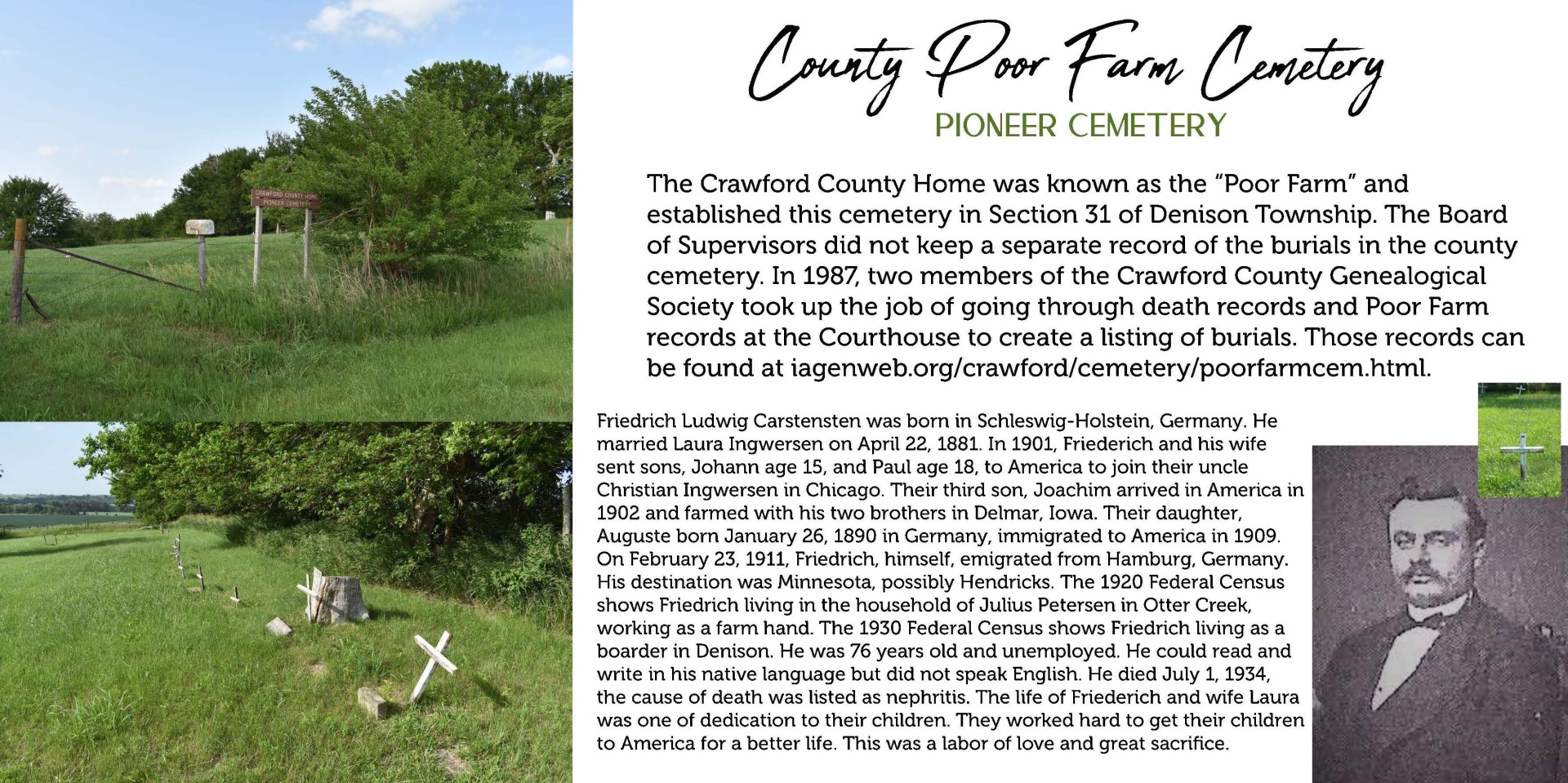
Poor Farm Cemetery
Latitude: 41.9505 · Longitude: -95.4308 · Google MapsDenison Township · Section 31, Township 83, Range 39 · Township Officials
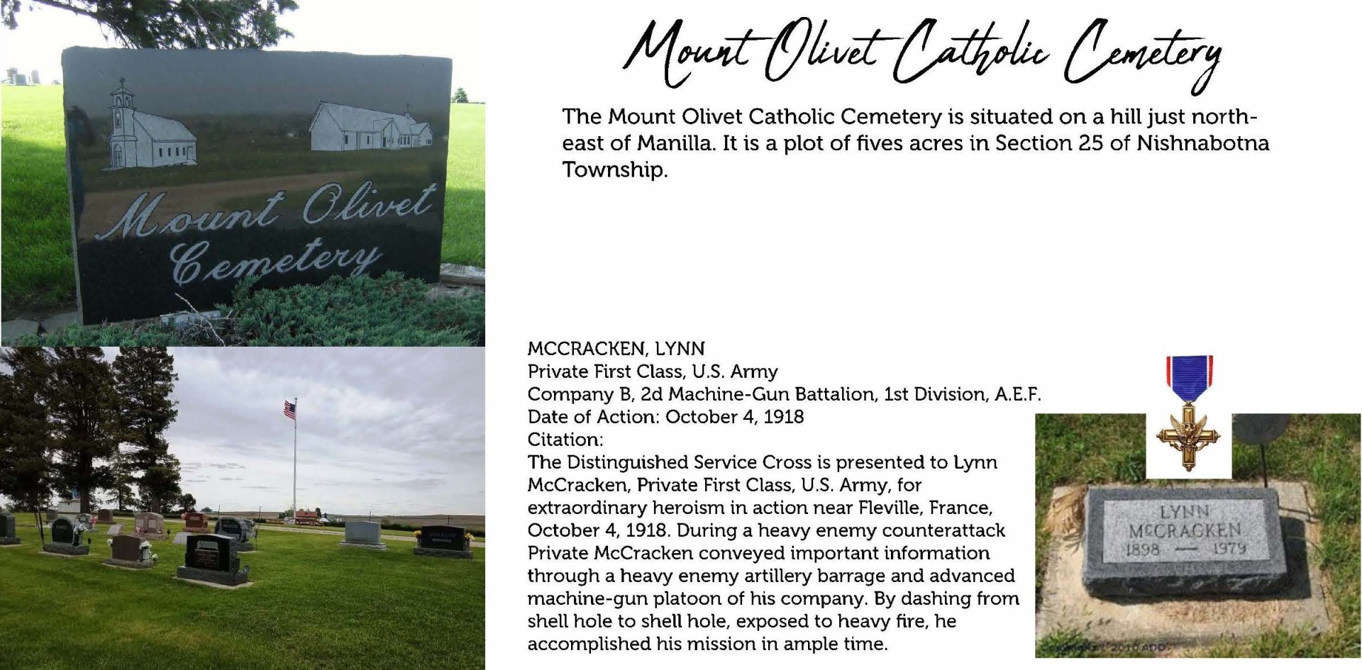
Sacred Heart Roman Catholic Church of Manilla (aka Mt. Olive)
Latitude: 41.8926 · Longitude: -95.2198 · Google MapsNishnabotna Township · Section 25, Township 82, Range 38 · Township Officials
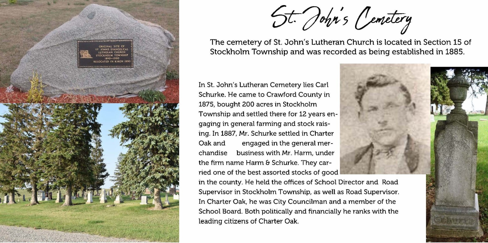
St Johns Lutheran Cemetery
Latitude: 42.1779 · Longitude: -95.2643 · Google MapsStockholm Township · Section 15, Township 85, Range 38 · Township Officials
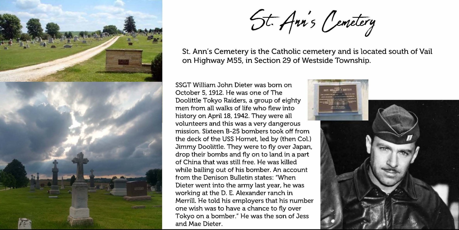
St. Ann's Roman Catholic Cemetery
Latitude: 42.0512 · Longitude: -95.1865 · Google MapsWestside Township · Section 29, Township 84, Range 37 · Township Officials
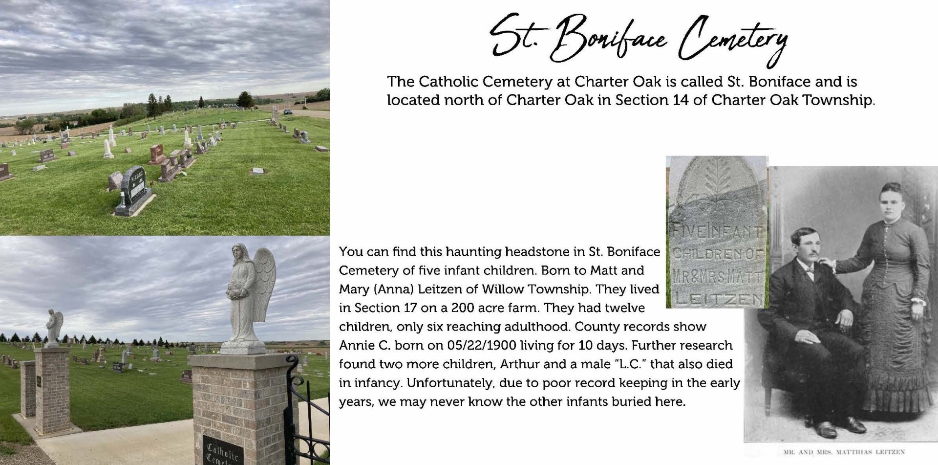
St. Boniface Roman Catholic Church Cemetery
Latitude: 42.0824 · Longitude: -95.5946 · Google MapsCharter Oak Township · Section 14, Township 84, Range 41 · Township Officials
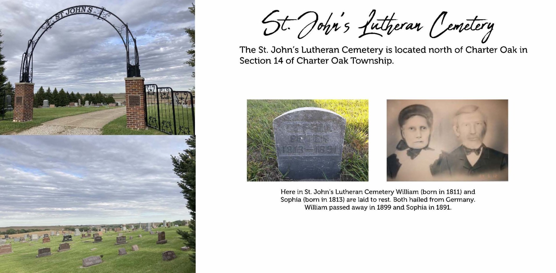
St. John's Evangelical Lutheran Church of Charter Oak Cemetery
Latitude: 42.0834 · Longitude: -95.5927 · Google MapsCharter Oak Township · Section 14, Township 84, Range 41 · Township Officials
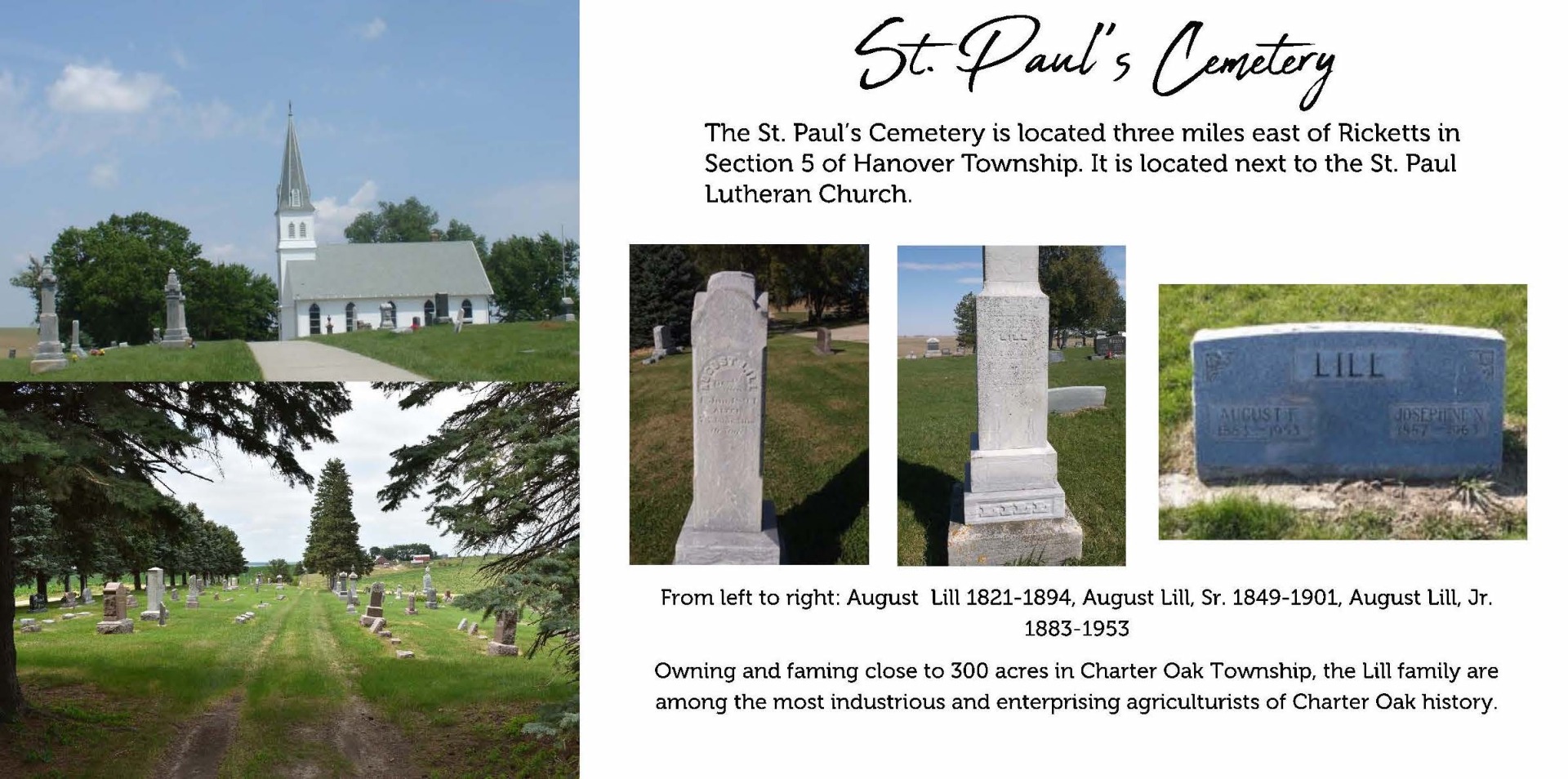
St. Paul's Church Cemetery
Latitude: 42.1217 · Longitude: -95.5265 · Google MapsHanover Township · Section 05, Township 84, Range 40 · Township Officials
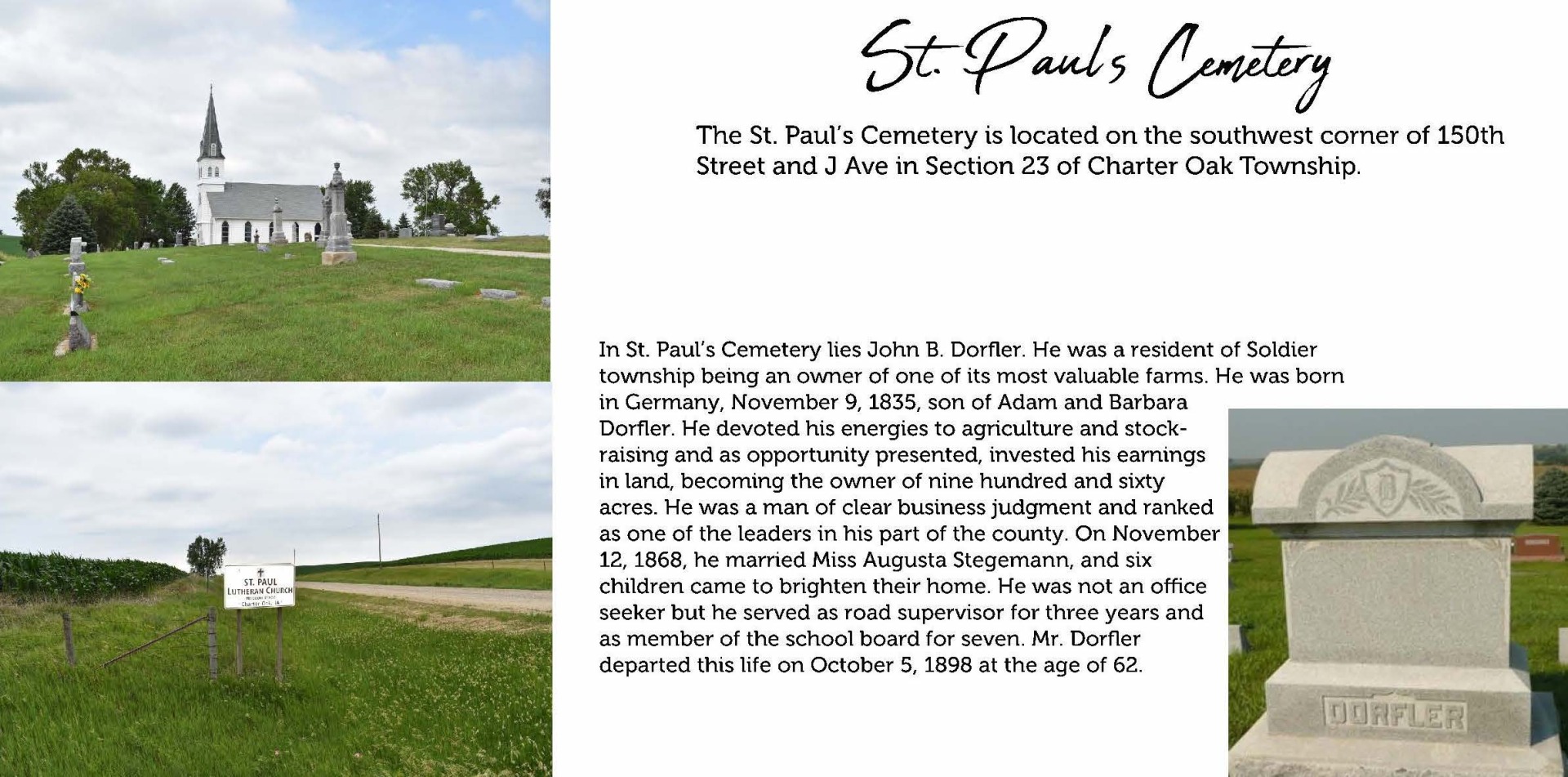
St. Paul's Evangelical Lutheran Church Cemetery
Latitude: 42.0800 · Longitude: -95.5753 · Google MapsCharter Oak Township · Section 14, Township 84, Range 41 · Township Officials
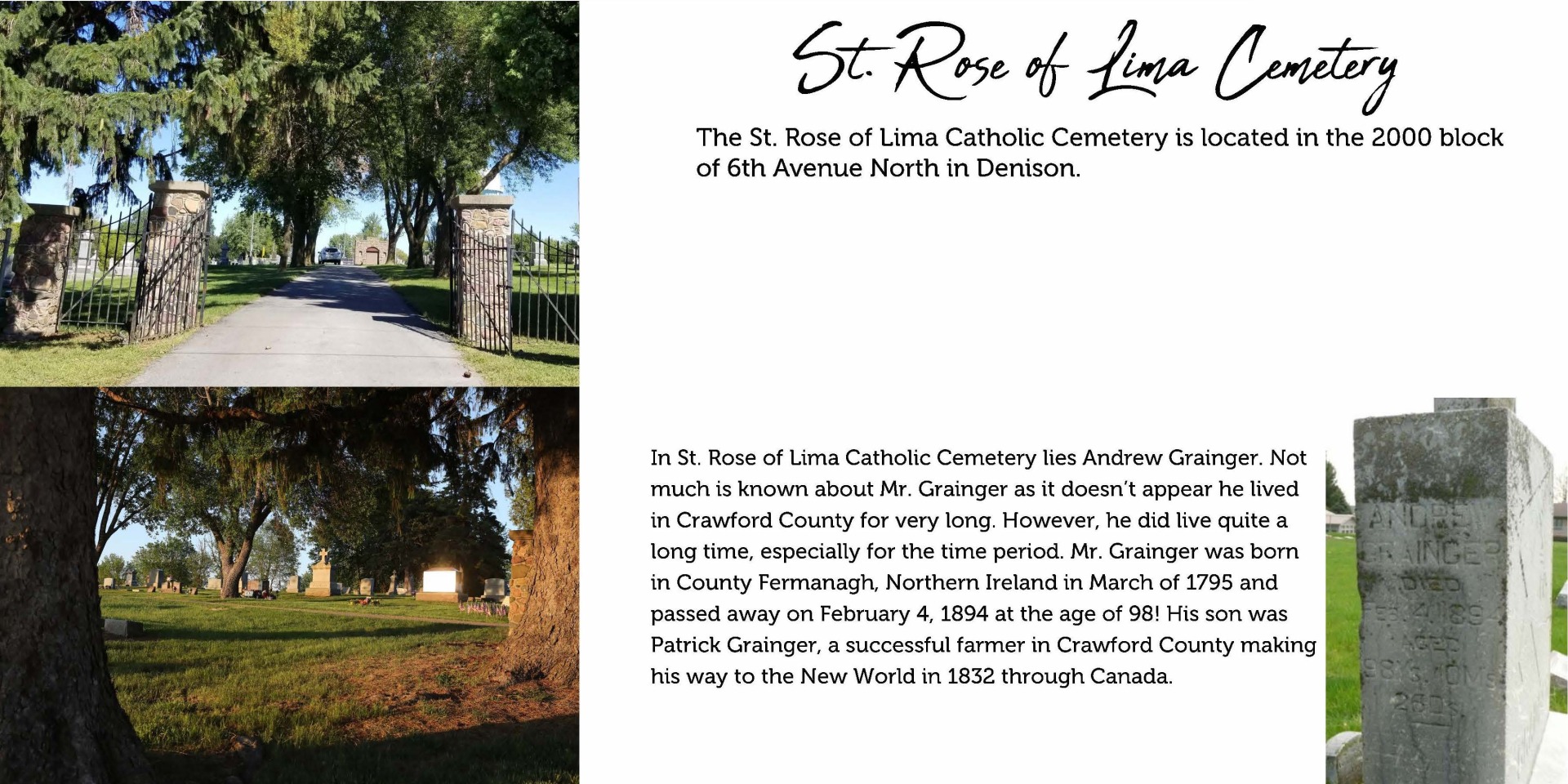
St. Rose of Lima Roman Catholic Cemetery
Latitude: 42.0238 · Longitude: -95.3393 · Google MapsEast Boyer Township · Section 18, Township 83, Range 38 · Township Officials
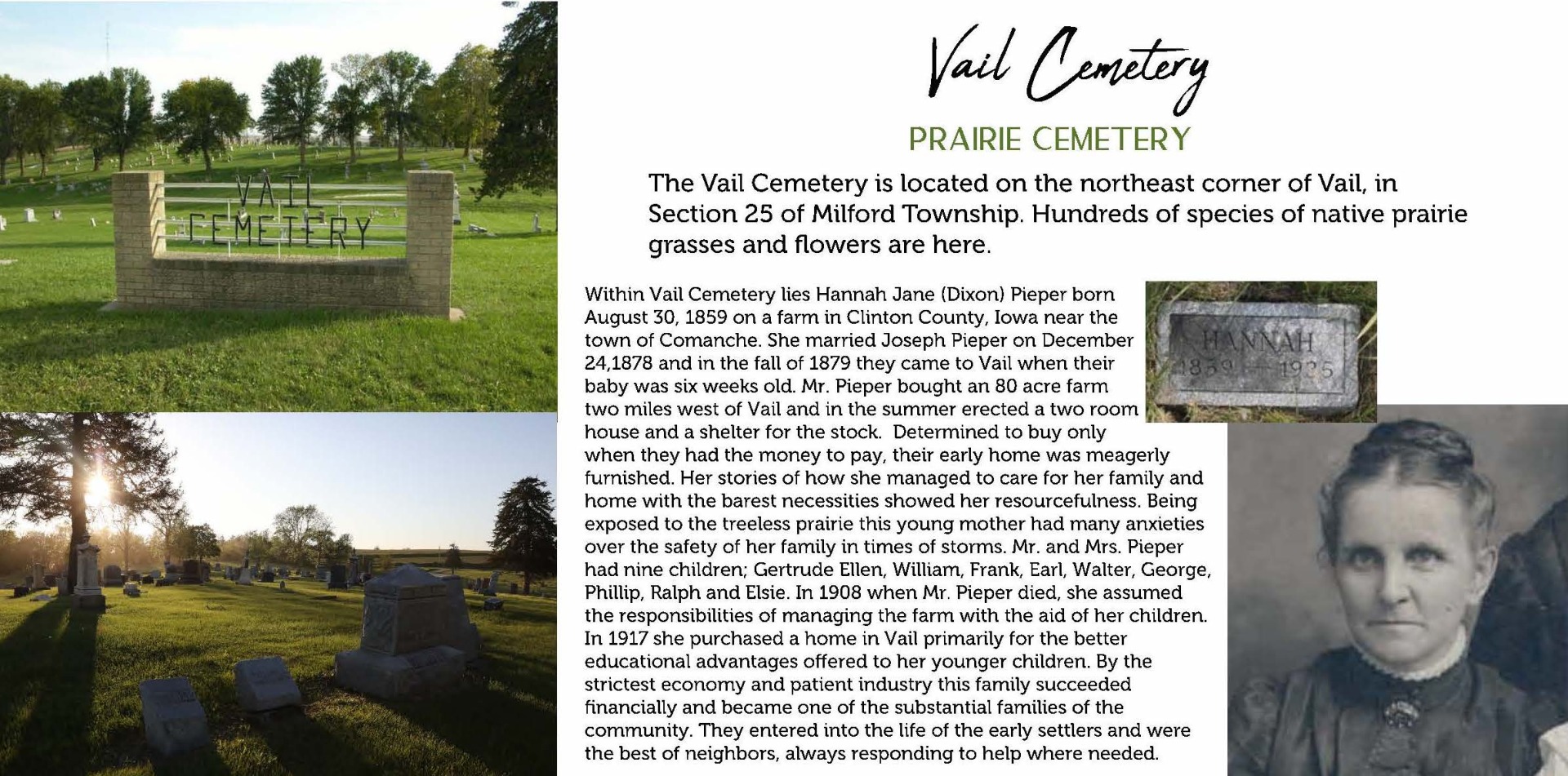
Vail Cemetery
Latitude: 42.0650 · Longitude: -95.2113 · Google MapsMilford Township · Section 25, Township 84, Range 38 · Township Officials
Valley View Cemetery
Latitude: 41.8647 · Longitude: -95.6256 · Google MapsBoyer Township · Section 33, Township 82, Range 41 · Township Officials
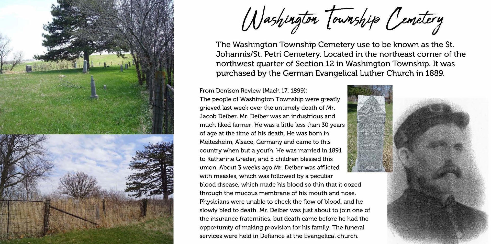
Washington Township Cemetery (aka St. Johannis./St. Petri Cemetery)
2725 T Ave, Denison, IA 51442Latitude: 41.9366 · Longitude: -95.3384 · Google Maps
Washington Township · Section 12, Township 82, Range 39 · Township Officials
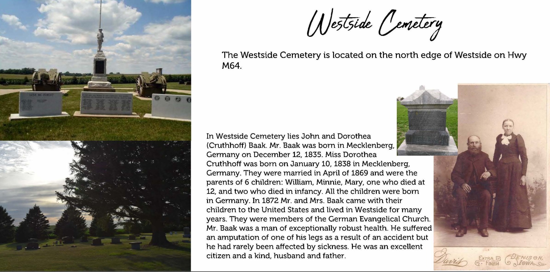
Westside Cemetery
Westside, Westside, IA 51467Latitude: 42.0814 · Longitude: -95.0927 · Google Maps
Westside Township · Section 13, Township 84, Range 37 · Township Officials
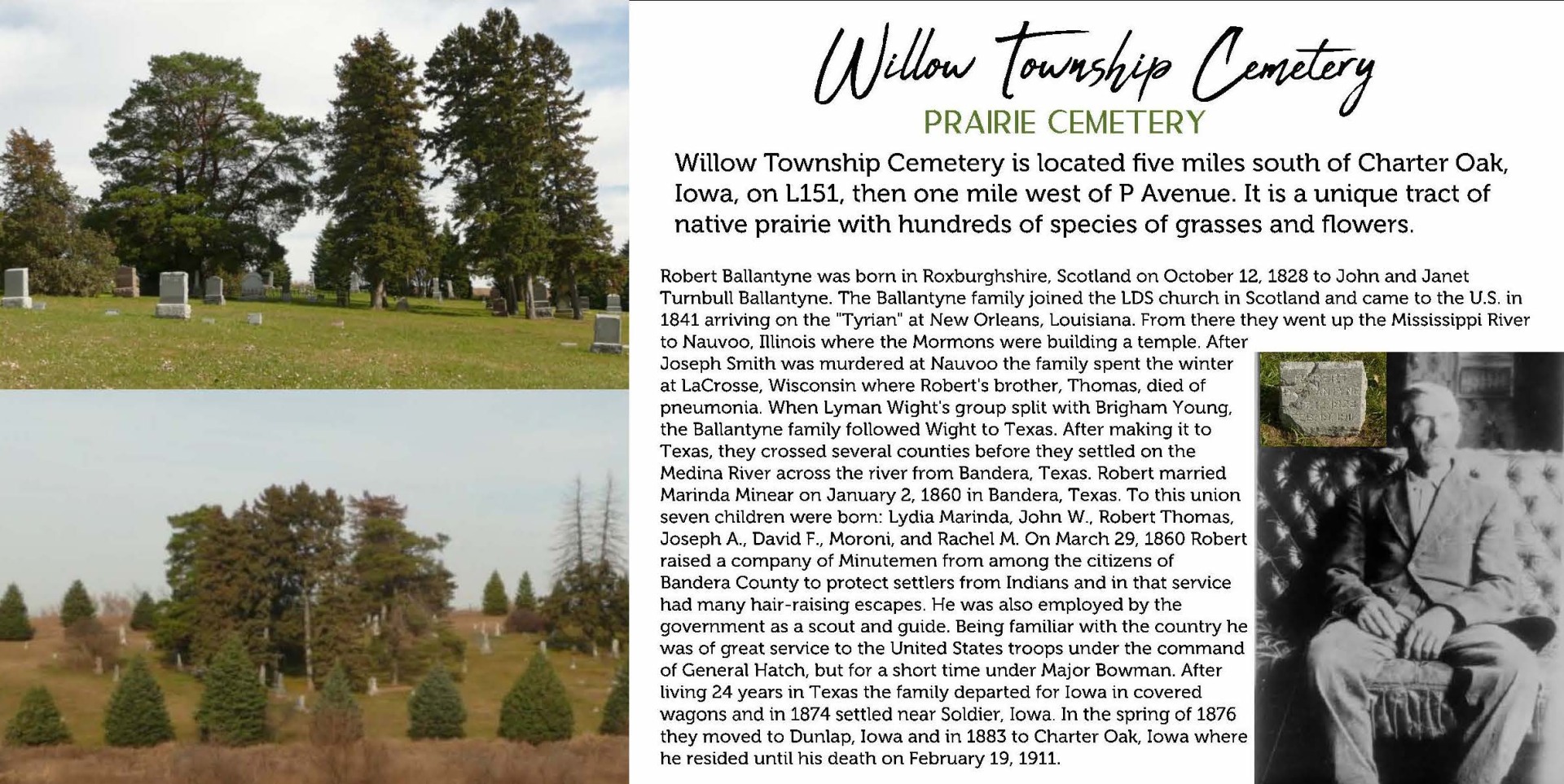
Willow Township Cemetery
Latitude: 41.9911 · Longitude: -95.6139 · Google MapsWillow Township · Section 22, Township 83, Range 41 · Township Officials
©2024 Crawford County, Iowa · Title VI Nondiscrimination Notice
